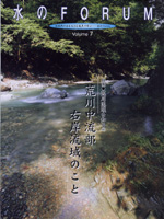
| The basin on the right bank of the mid-stream of the Arakawa River |
|
The geography of this basin consists of mountains, hills and large tableland, which is rare in Japan. The tableland supported the life of people for over 10,000 years of the Jomon period (10,000-400 BC) with the bounty from the nature, both sea and mountains. The long continuing period of Jomon culture was dramatically changed by the rice cropping which was imported into the northern region of Kyushu Island from China around BC 4 Century. It quickly spread throughout Japan, and brought about the Yayoi Culture, which centered on rice cropping. In the Ksnsai region, in which the rice cropping was introduced very quickly, the Yamato Imperial Court governed local powers and monopolized iron and imported latest technology, and established the ancient imperial regime. In 646, the regime declared that all land and people belong to public (emperor), which accelerated the spread of paddy fields throughout Japan. However, due to heavy taxation on farmers led to the collapse of the political and financial foundation of the regime, and local aristocrats and temples came to own the paddy fields. The privately owned land and politics caused poor security, which then led to the organization of samurai or worrier groups led by major local ruling families. The worriers in the Musashi (or Saitama) region fought fearlessly to protect the lowland developed by themselves and contricuted to the creation of the Japan's first feudal government, Kamakura Shogunate, in 1192. The center of the Musashino Plateau at that time was dry land and was the major battlefield. This Musashino Plateau, once the battlefield, was changed to crop field and wooded area in the Edo Period (1603-1867). In 1639, Matsudaira Izunokami Moritsuna, the castellan of Kawagoe castle (in Saitama) was committed to the cultivation of the dry tableland by launching the project to cut Tamagawa Josui Canal of about 44 km long. On the following year, the canal was branched into the north of the Musashino tableland to build "Nobidome Canal". It was very useful in providing drinking water and crop growing. It was followed by the development of Santome paddy field of about 1400 ha in 1964. The Santome paddy field was developed by dividing the site into strips, in which every household has the upland field sandwiched by thicket and homestead woodland and the independent production and discharge cycle. This recycling-style agriculture still remains in some farms, which attract many visitors from the world. The thickets of sawtooth oak, quercus serrata and red pine trees, symbolizing the Musashino region, grow on the upland fields on the highland rather than lowland. The lowland has fertile soil carried in by flood and is fed with nutrients-containing irrigation water. The highland, on the other hand, has no such blessings and the cropping there needs the feeding of a large amount of organic substances. This is why thickets consisting mainly of deciduous broad-leaved forest had to be fostered to produce compost from the falling leaves. It is known that a large quantity of organic fertilizer was used in the field. It is also known that approximately 9 tons of organic substance is produced per hectare per year in the thicket of quercus serrata trees. In the Musashino highland, after the land is burned and left for sometime, artemisia plants grow, replaced then by Japanese silver grass and bamboo grass. Within over 10 years, they are replaced by sawtooth oak and quercus serrata forest (second-growth forest) and then pasania and Quercus myrsinaefolia forest (climax forest). Thickets in the Musashino region is the second growth forest which has been maintained by the human help. The soil containing the compost from the forest is black, soft, warm, indicating the fertility of the land. The land in Japan consists of the lowland for rice cropping and the highland for and thicket, both of which were developed by the hands of farmers. This valuable land faces a serious threat of being disappear not only by the urbanization but also modernization of agriculture. |
| UK Environment Agency Flood Risk Management |
|
We visited the Environment Agency in Milllbank on November 2, 2005. To the questions we sent in advance, they were very kindly to prepare the documents containing key facts in the Asset System Management and Enforcement for England and Wales. They provided us with a lot of very informative knowledge including the risk of high-tide flood in the basin of The Thames in London. Key facts for England and Wales üEThe Environment Agency is a non-departmental Government body. Our sponsoring Government department for policy and funding in England is the Department for Environment, Food and Rural Affairs (Defra). In England local levies can be set by Regional Flood Defence Committees to raise additional funds for local priorities. In Wales the Welsh Assembly Government (WAG) sets policy and provides funding. üEOur Head Office liaise with Government and other national and international organizations and turns policy into processes that set how we will do our work in a consistent, efficient, effective and equitable way. üEWe have 8 Regions and 26 Areas that deliver flood risk management in addition to regulating waste management, pollution control and the use of water resources. We also have navigation, fisheries, recreation and amenity in our remit and a duty to further biodiversity and these aspects are also delivered in Regions and Areas üERiver and coastal flooding is the natural disaster most likely to affect people, their homes and businesses in England. Flooding is a significant threat to life and health: two people were killed as a direct result of the recent flooding in Carlisle in January 2005, five in the floods of April 1998 and over 350 in the coastal flooding of1953. Even where no loss of life occurs, flooding is highly stressful. üEUp to five million people and two million homes, businesses and other buildings in England are in areas which, in the absence of man-made flood defences, would flood more than once every hundred years at an annual cost of some 3 billion GBP. In addition, the risk of flooding, especially along the coast, is likely to increase significantly over the next century as a result of climate change. üEFlooding still causes extensive economic loss through damage to private property and public assets, severe transport disruption and production losses. Estimates are that flooding in unprotected areas, and where existing defences are overtopped, causes damage costing 1 billion GBP in an average year. This means that our defences and flood warnings save England and Wales around 2 billion GBP each year. üEWe employ some 3,200 staff on flood management duties (including 1,600 manual workers) üEThere are approximately 41,000 km of Main River on which we have powers to carry out work (this will increase in 2006 when the remaining 1,181 Critical Ordinary Watercourses are enmained.) üEThere are 3000 flood risk management systems (geographic areas defining groups of assets that contribute to reducing flood risk at specific locations) üEThere are approximately 24,500km of raised flood defences - embankments, walls - of which 6,500 km (26%) are in urban areas. üEThere are around 44,500 flood defence structures - outfalls, sluices, barriers etc - of which 11,500 (26%) are in urban areas. üEWe spent 200 million GBP on improved and new flood defences in 2004/5 (planned spend of 258 million GBP in 2005/6. üEWe completed 45 flood defence schemes during 2004-05 with an average benefits to costs ratio of 8.6. üEWe are on track to deliver a three-year programme of improved flood defences for 78,000 more homes by March 2006. This is 6,000 more than the target set by Government in 2003. üEFlood defence assets in England and Wales have a replacement value of over 20 billion GBP. üEWe spent 122 million GBP on maintenance of assets in 2004/5 (planned spend of 159 million GBP in 2005/6). üEWe spend 11 million GBP annually on dredging and aquatic weed cutting. üEWe spend 17 million GBP annually on maintenance of major mechanical assets - pumping stations, sluices etc üEWe spend 6 million GBP annually on grass cutting on embankments. üEWe have a target that less than 30 per cent of defences in urban areas will be in fair condition or worse by 2008, and no more than 3 per cent will be in poor condition or worse. |
HOME
Copyright ř 2002 Japan Water Forum. All rights reserved